Erodible Soils Report
What is an erodible soils report?
The Erodible Soils report provides a broad scale ranking on the potential for a soil to erode in the user-selected area based on soil attributes in the surface and subsoil. Three maps are produced: a surface map, subsoil map and overall erodibility map.
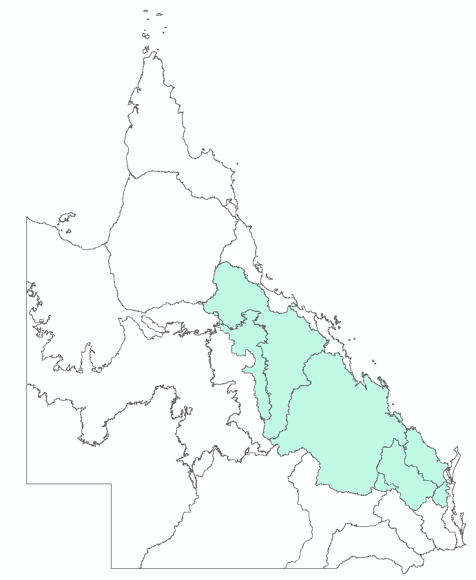
The report is currently available for the Burdekin, Fitzroy and Burnett-Mary catchments/regions. The locality map below shows the areas for which the report is available.
What is included in this report?
The Erodible Soils report provides information on how likely the soils on a particular location in the Burdekin, Fitzroy and Burnett-Mary catchments/regions are susceptible to erosion through three maps:
- overall soil erodibility
- surface soil stability
- subsoil erodibility
- a GeoPDF file showing georeferenced data that relates an image from the PDF report to coordinates on a map - allowing the user to have some limited mapping functions such as turning map layers on and off. The GeoPDF for this report can be used in applications such as Avenza maps or Adobe Acrobat.
Note: there are no legends on the geoPDF files. To understand the categories when you are using the geoPDFs onsite, you need to reference the legend on the pdf report (digital or printed).
Soil erodibility on these maps is the likelihood that a particular soil is going to slake and/or disperse and be susceptible to erosion.
The maps were produced for regional or sub-catchment investigations, for example comparing soils in major tributaries of rivers. The maps were produced at a scale of 1:250,000 where 1cm represents 2.5km.
Report sample
Report sample is available online here (PDF, 1.4 MB)
Soil erodibility ranking map sample is available online here (GeoPDF, 102.0 KB)
Common questions about erodible soils reports
-
Erodible Soils reports are available for a selected Lot on Plan or adjoining Lots on Plan for the Burdekin, Fitzroy and Burnett-Mary catchments/regions.
-
For more details, see the Soil Erodibility User Guide (PDF) .
Three maps are produced for the selected Lot on Plan or adjoining Lots on Plan:
- Overall erodibility – ‘Overall soil erodibility ranking’ map
- Surface soil – ‘Surface soil stability’ map
- Subsoil – ‘Subsoil dispersibility’ map
-
Soil attributes used include the amount and type of clay including clay composition (sodium and magnesium ion balance) and the salinity of the soil solution. For more detail on these attributes, see Page 5 and Glossary in the Mapping erodible soils in Burdekin Dry Tropics grazing lands User Guide to datasets .
-
These attributes affect the likelihood that a particular soil slakes and/or disperses and whether a soil is cohesive or not.
-
The soil erodibility ranking does not take into account external factors such as topography (slope), land use and land management, rainfall intensity and ground cover.
No. This soil erodibility classification does not take into account other factors such as topography (slope), land use and land management, rainfall intensity and ground cover.
The information on potential soil erodibility and soil attributes can be used to identify areas at risk of soil erosion and hence help with land management decisions.
For example:
- Use Map 2 (surface soil stability) to determine the nature of your surface soil.
- Then use Map 3 (subsoil dispersibility) to determine the nature of your subsoil.
- Using the table on Page 1 of the report, determine your soils' likely attributes. The colour of the table cell correlates with the erosion vulnerability ranking in Map 1 (overall erodibility ranking).
- Consider your soil attributes in conjunction with the surrounding landscape (e.g. slope and vegetation cover), stock numbers and climate to assess erosion risk.
The maps were produced using data from existing and new soil profiles and data derived from airborne geophysical surveys, digital terrain models, climate and Landsat/MODIS satellite data. The data were combined using digital soil mapping methods to produce soil attribute maps. These soil attribute maps were used in a model of soil erodibility to produce the maps in this report.
For more information on these attributes, refer to the Mapping erodible soils in Burdekin Dry Tropics grazing lands User Guide to datasets .
This report aims to rank soil potential to erode (soil erodibility), not the presence or absence of erosion. Soil erosion is influenced by numerous factors including land management, rainfall and topography as well as the soils erodibility. The maps were made using soil and land information with a resolution greater than 1ha, hence the map cannot show fine scale variations in the landscape. However, the maps are suitable for regional or catchment scale assessments.
Other information
For further information refer to the Erodible Soils User Guide . Information about soil erosion is also available.
